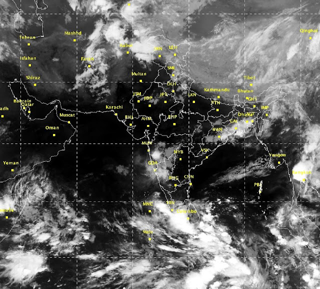
The area of convection previously located in the South East Arabian sea has moved eastwards and formed into a Low pressure area today the 14th of May 2016 near the southwest coast of Sri Lanka.
The area would move north-north eastwards over the next two days or so and strengthen into a depression / deep depression by the 16th.
It would move northwards skirting the east cost of India. Rainfall expected across most of south India from the 16th onwards.
The system after dumping heavy rainfall across the southern peninsula and weakening into a Low pressure would emerge again into the Bay of Bengal and strengthen again into a deep depression or Cyclone by the 19th.
It would then move North eastwards before crashing into West Bengal and Bangladesh by the 21st. Expect Pre-monsoon showers to peak over most of the country by the 23rd - 24th of May.
This system will help pull in monsoon moisture & winds from the bay and the monsoon will cover the Andaman and Nicobar islands between 17th - 19th May, Onset over Kerala is expected around the 30th of May 2016.
Heavy to very Heavy rainfall expected along the west coast of India - Kerala & Coastal Karnataka between 15th - 18th May. Also Heavy rainfall expected along east coast as well from Nagapattinam to Machlipatnam between the same dates.
Interior Tamil Nadu and Karnataka will also have moderate to heavy rainfall from the 15th onwards.
Next update - Monsoon onset update 28th May.


No comments:
Post a Comment
Have something to say??