The monsoon has been below normal in August over most of the country except for excess rainfall over the plains and Rajasthan.
Southern India bore the brunt of this deficit with Kerala recording one of its lowest August rainfalls since 1980. Karnataka and Tamil Nadu also not doing so well with most dams almost reaching dead storage levels.
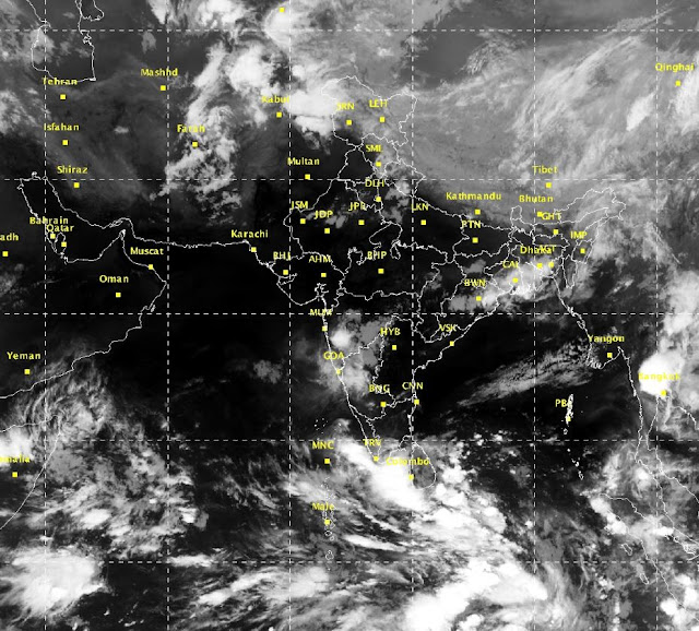
The east coast and the bay was busy with quite a few UAC's(Upper Air Circulations) & Low pressure areas forming almost every week. Unfortunately for Southern India the systems all moved North-North west and except for a few thundershowers, Andhra and Telangana have been left high and dry.
September did not show too much promise as well with another system forming near coastal Andhra but moving North again. The first half of September seems to be moving in the same direction as August except if a system currently in the Bay strengthens and is expected to make landfall over Andhra Pradesh and this should bring good rainfall to parts of inland peninsula India.
However, the extreme south of the country which includes parts of Tamil Nadu, Kerala and Karnataka will still have mainly dry weather.
With withdrawal beginning over Pakistan, North India will have its last week or so of rainfall as the axis of monsoon trough still persists over gangetic Uttar pradesh and Bihar moving north towards Haryana.
East India has beein in a drought of sorts with Assam, Meghalaya, Nagaland, Manipur & Tripura all receiving deficient rainfall over the whole monsoon since June.
South India should see prospects improving after the 15th of the month with another system in the bay expected to strengthen and cross land near machlipatnam and should bring widespread rainfall to most of the southern Peninsula barring Extreme south and interior Tamil Nadu. With the monsoon retreating the axis of monsoon trough will also begin to start moving southwards.
I look forward to a Mixed month for different parts of the country and see the monsoon exit the entire country by the 9th/10th of October 2016 and this will also commence the North East Monsoon and the raint season of Tamil Nadu and Andhra.
Enjoy the last of South West Monsoon 2016, Stay Safe.
Next report on 10th October, monsoon withdrawal and NE Monsoon onset report


